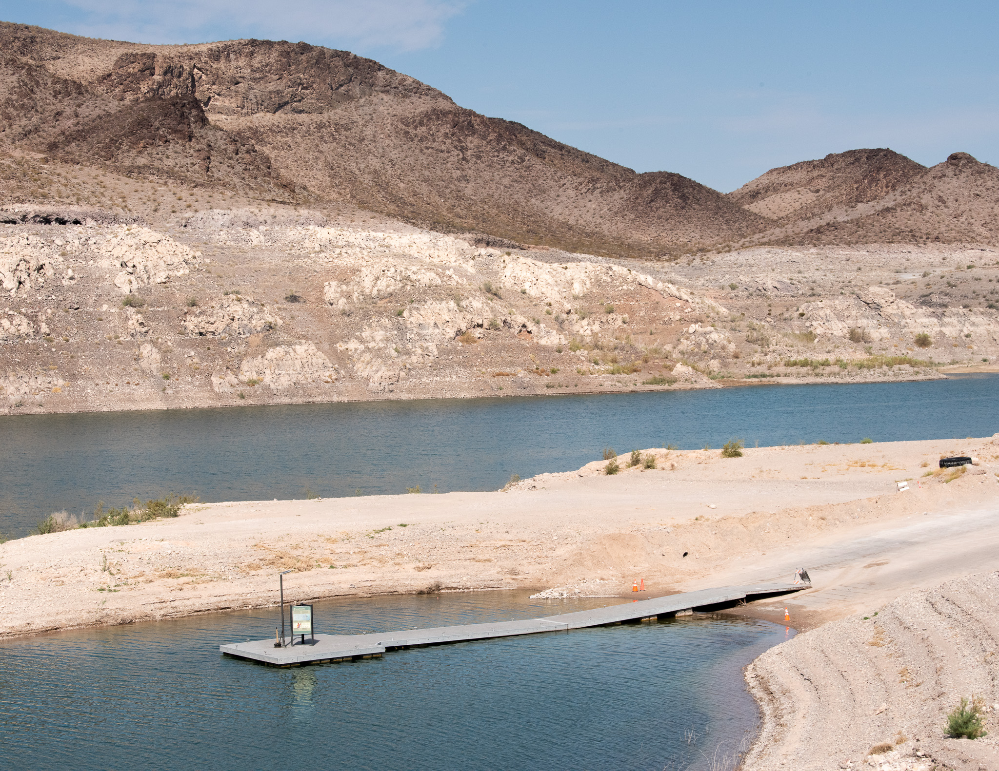
We’ve never seen anything like it.
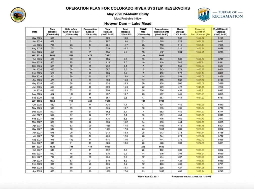
This month’s predictions from the federal government about future elevations of Lake Mead during the next two years are the scariest ever released.
In 2000, Lake Mead’s elevations hovered around 1200 feet above sea level. Today they are about 150 feet lower. In the coming years, we expect an additional 30-foot drop.
This means we will be closer to the minimum power pool elevations and approximately 130 or so feet away from dead pool (elevation 895). That big drop, known as the bathtub ring, took a decade or so to show itself. The next 100-foot decline won’t take as long.
Lower reservoirs mean less water in storage and fewer electrons generated at the dam. It creates uncertainty for the economy and river ecologies. As water elevations drop, the reservoir shrinks even faster. It’s a compounding effect. Vegas can take water out of Mead below dead pool because of the “third straw.” But Phoenix, Los Angeles, Tribes, and agriculture don’t have that luxury.
For years, we’ve said that Congress, i.e. taxpayers, will ultimately pay the price to fix a river system that was over-built and over-allocated from the beginning.
Money is probably the only thing that will salve the wounds between the Upper and Lower Basin states.
The blame game among them is as frustrating as it is never-ending. But there are some undeniable facts:
The Lower Basin should take the most cuts because they use more. They have agreed to take more than 1.5 million acre feet of annual reductions. It’s probably going to have to be larger than that.
However, the Upper Basin is not proposing any meaningful, mandatory conservation measures. And, in fact, regulators in those states are approving permits for more inter-connected surface and groundwater in those systems.
Furthermore, the Upper Basin says that Mother Nature imposes cuts naturally on its surface waters in dry times. But no one discusses the groundwater pumping connected with the river system. Usually, when surface water flows decrease, pumping increases. That’s not being discussed in any public way right now. Upper Basin water regulators must curtail groundwater pumping and stop handing out new permits. There’s no water available.
All states must get better at calculating evaporation, seepage, channel losses and other natural means of depletion.
Farms have to get more efficient as residential communities must begin to adapt to aridity.
Lastly, large-scale water recycling and desalination must be on the table. But they should not forgo proper environmental reviews.
Nevertheless, the states aren’t any closer to a deal and we are a few months away from October, the beginning of the 2027 water year. Most likely, the long term plan won’t look too far away from what we currently have. The Lower Basin is committing to cuts, and the Upper Basin is handing out new permits.
Paper water logic is pretzel logic.
There’s a lot more to consider.
Here are GBWN’s recommendations for a more stable Colorado River System.
Hear more from GBWN on NPR’s Marketplace.
.
